
Hiking
Quick Nav
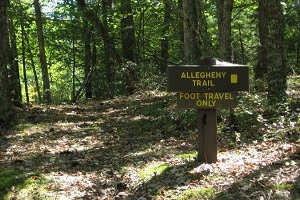
Allegheny Trail
The Allegheny Trail was West Virginia’s first long distance hiking trail with over 330 miles maintained and preserved specifically for West Virginia Hiking. Passing through Durbin and the Seneca State Forest, and by West Virginia Tourist Attractions like the Green Bank Observatory and Watoga State Park, the Allegheny Trail is popular among hikers, mountain bikers, backpackers and even fishermen. The Allegheny Trail West Virginia is sectioned into four separate tracts of trail with each segment managed by a different set of volunteers. Drop by the Pocahontas County Visitors Center to pick up a map before starting your adventure.
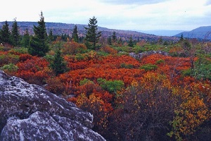
Cranberry Wilderness
The Cranberry Wilderness Area is one of the most serene and remote areas in the region. Situated between Pocahontas County and Webster County, this wonderfully preserved region covers 47,815 acres in the Monongahela National Forest. This area includes the entire drainage of the Middle Fork of the Williams and the North Fork of the Cranberry River. Elevations range from 2400 to over 4600 feet. Wilderness trails are maintained with a narrower tread and pathway than other Forest Service Trails. Trails are marked only at junction and there are no bridges at stream crossings. Grab a map at the Cranberry Nature Center before you start your adventure.
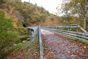
Greenbrier River Trail
West Virginia's beautiful Greenbrier River Trail is one of America's premier rail trails, and is popular with hikers, bicyclists, horseback riders and cross country skiers. It is the longest trail of its kind in West Virginia, with the river flowing north to south, from Cass to Caldwell. The trail passes through several towns, crosses 35 bridges, goes through 2 tunnels and cuts through some of West Virginia's most remote areas. The trails one percent grade and numerous access points make it accessible to hikers and bikers of all abilities. Pick up a map at one of the Pocahontas County Visitor Centers before starting your adventure.
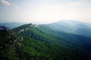
North Fork Mountain Trail
Outside Magazine called this West Virginia trail one of the best in the state, as it offers 24 miles of great hiking along the northern section of the mountains. Following the ridge line of the majestic North Fork Mountain, hikers can enjoy the numerous overlooks near Seneca Rocks, and view the gigantic rocky outcroppings that appear every few yards or so. The mountain scenery along this trail is stunning,but be sure to pack a lot of water along with you as there are few mountain rivers and streams along the North Fork Mountain Trail.
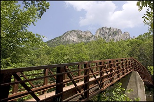
Seneca Rocks/ High Meadows Trail
This hiking trail area features a popular loop hike which takes hikers through the Seneca Creek Backcountry with its beautiful rolling meadows, waterfalls, and gorgeous rivers. By hiking in this area, you can easily reach Seneca Creek and see the beautiful Upper Falls of Seneca, a gorgeous West Virginia Waterfall that is a spectacular place to snap some pictures. If you continue on you’ll come to the High Meadows Trail which takes you through valleys near the old logging trail which is often a bit muddy due to flooding in the area.
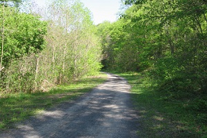
West Fork Trail
The West Fork Trail is a West Virginia Hiking trail located in northern Pocahontas County and is located along the gorgeous West Fork of the Greenbrier River. The 26 mile long trail follows an old railroad grade and is one of the better railroad turned hiking trail areas in West Virginia. With a very gentle grade, hikers can enjoy the stunning scenery and blooming wildflowers each spring and summer. The West Fork Trail leads to a remote section of wilderness near the Greenbrier River watershed which provides a great, rural experience in the mountains. In the winter time, visitors use the West Fork Trail for West Virginia cross country skiing. The area is open to hikers, bird watchers, and fishermen. However, no hunting, horseback riding, or ATV vehicles are allowed on the West Fork Trail.
.jpg)
Falls of Hills Creek
The Falls of Hills Creek is one of the best known Attractions in West Virginia. This 114 acre area is tucked away in the Monongahela National Forest and is easily accessed via Route 39. Visitors can venture into the thick forest and discover the three falls that cascade down the mountain, each more stunning than the last. Flowing from Hills Creek, which is one of the cleanest streams in West Virginia, these West Virginia Waterfalls create some truly spectacular scenery. Visitors can walk to the boardwalk and look out at the first waterfall which drops 25 feet, and continue down the wooden steps to see the second waterfall which crashes a staggering 45 feet to the creek below. The last set of falls cascades down 63 feet and is the most beautiful of all three. In addition to the waterfalls, this area has an abundance of blooming flowers, with over 40 varieties of wildflowers growing in this region. Be sure to bring your camera when visiting this beautiful area in the Monongahela National Forest in the beautiful mountains of West Virginia. First Tracts specializes in West Virginia Monongahela National Forest Real Estate and Cabin Rentals in the West Virginia Mountains. Contact us for all of your real estate and rental needs near Snowshoe Mountain Resort.
.jpg)
Snowshoe Backcountry
Snowshoe Mountain Resort has some great hiking right out your door. Trails can be accessed from Shavers Lake or the general parking lot by the Soaring Eagle Lodge. Much like Snowshoe's ski slopes, hiking options range from easy to difficult. Grab a map from the Depot or the Mountain Adventure Center in the village, and explore Snowshoe's backcountry.